


NAVARRA - Diversity Cycle Tourism -
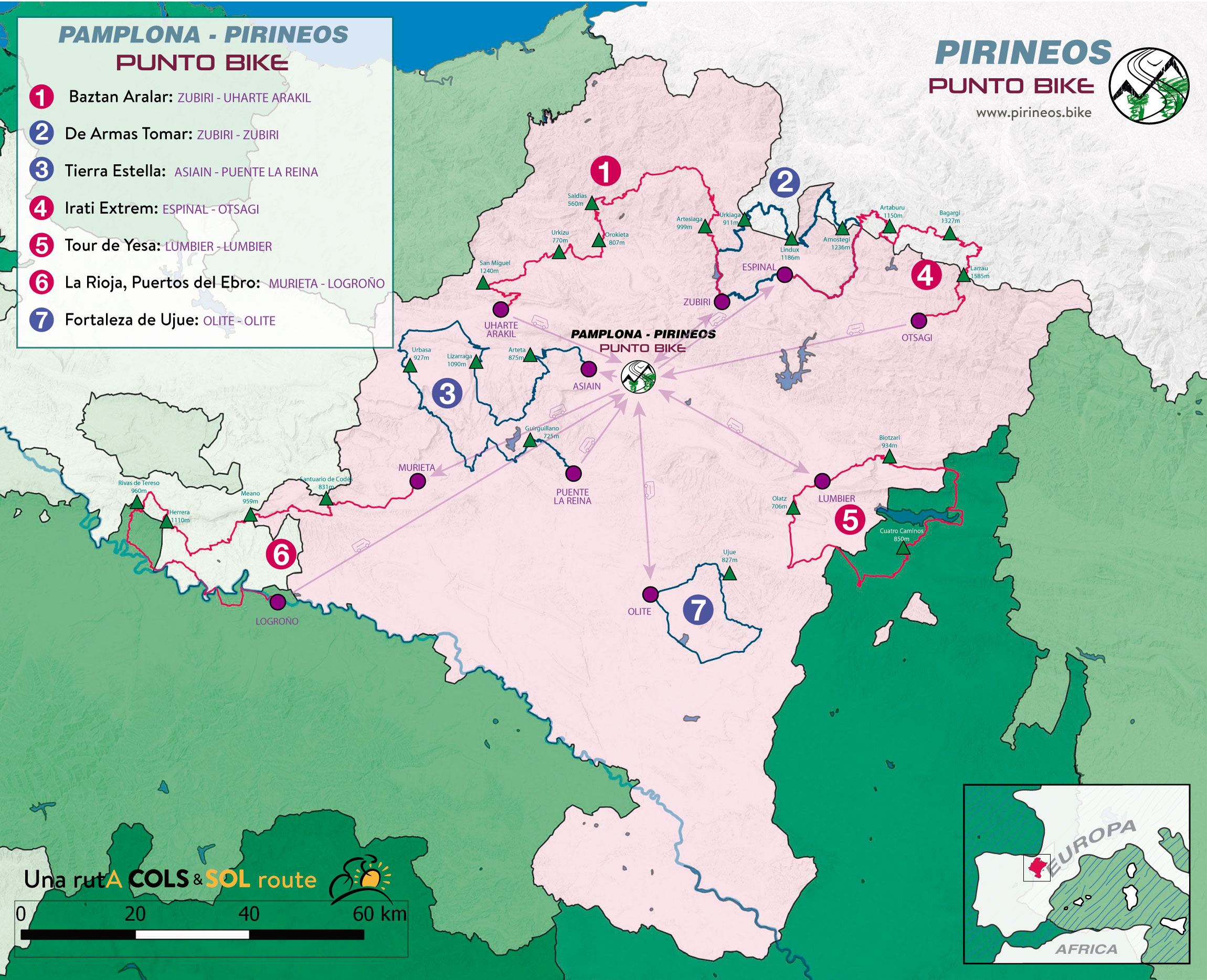
PAMPLONA - PIRINEOS PUNTO BIKE
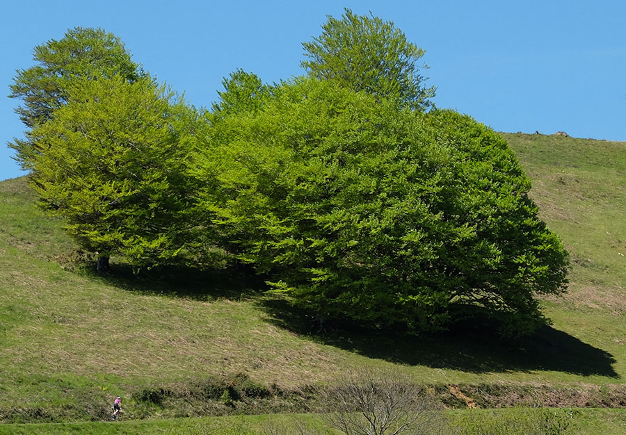
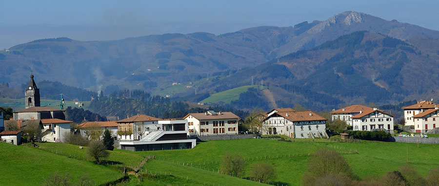
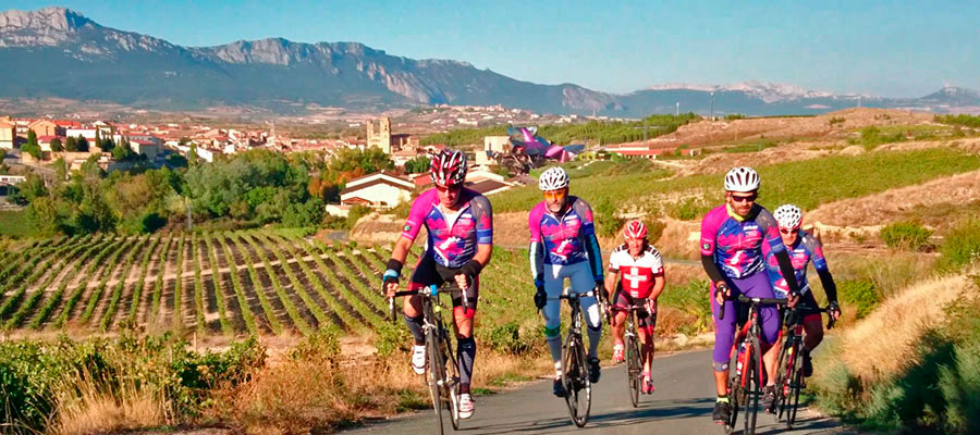
NAVARRA is a place full of cultural and geographical diversity. In just 100 kilometers in a straight line we pass from the PYRENEES - with its mountain culture - in the North, to the plains of the banks of the Ebro in the South. In between, the Middle Zone and the Pamplona Basin, a territory on the one hand full of history; Populations Vascones, remains of Roman Towns, Medieval Fortresses, Monasteries, Castles ... and by another one of a great variety of different natural spaces. All this combined with the tranquility of the territory makes NAVARRA an absolutely exceptional place for cycling.
It is no coincidence that today NAVARRA is home to 2 professional cycling teams, Caja Rural and Movistar, one of the best cycling formations, but the best in the world. It is also no coincidence that besides being the birthplace of the Tour's five-time champion, Miguel Indurain, is or has been the place of residence of many professional cyclists such as Nairo Quintana, Denis Menshov, Vladimir Karpets, Vasil Kiryienka or Fabio Roscioli - They chose this land for all that it offered -
The image that appears under these lines is an explanatory map of one of our commercial proposals, but it serves to get an idea of what a Stage in NAVARRA can consist of. To choose the routes you can resort to the available ones in the PUNTOS BIKE de SAKANA-ARALAR, ISABA-ARETTE and KINTOAN BARNA.
For zoom in or
To get the idea of the possibilities and real potential of a STAGE PIRINEOS PUNTO BIKE in IRUÑEA-PAMPLONA click and browse here in the tabs Navarra North, Media and Peripheral.
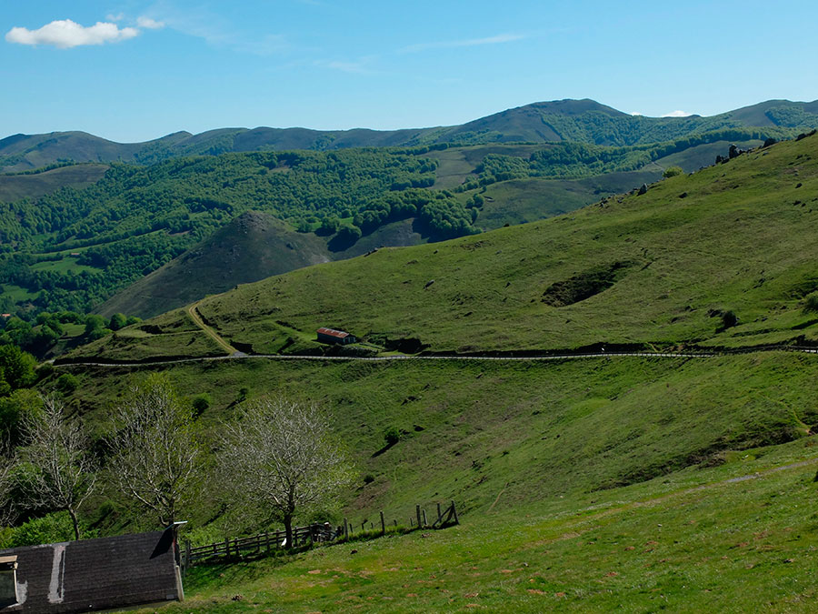
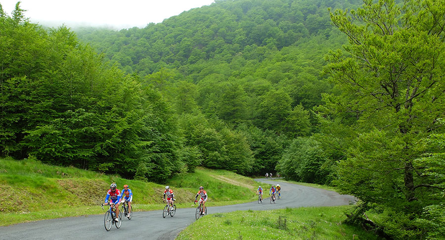
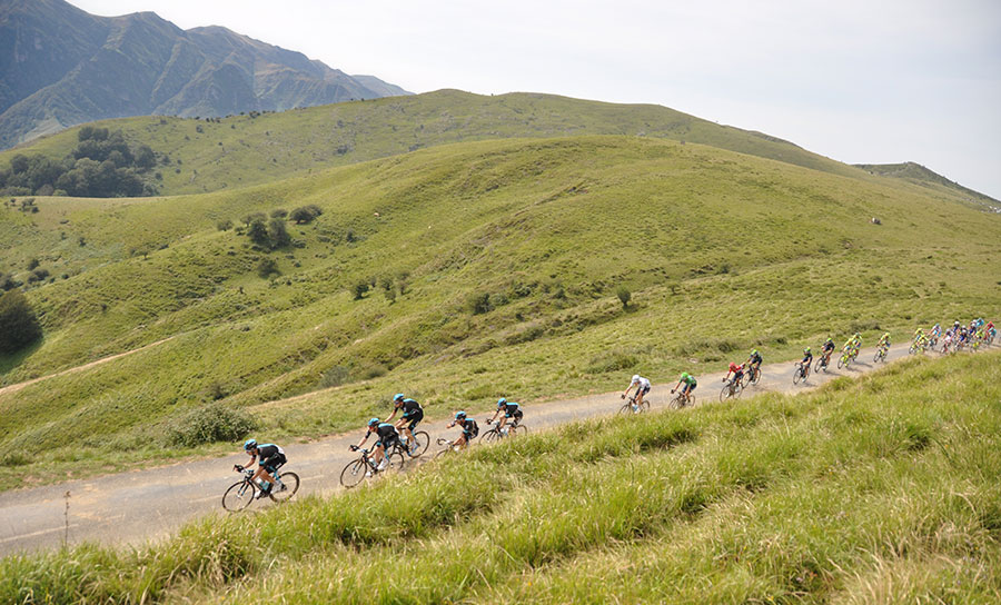
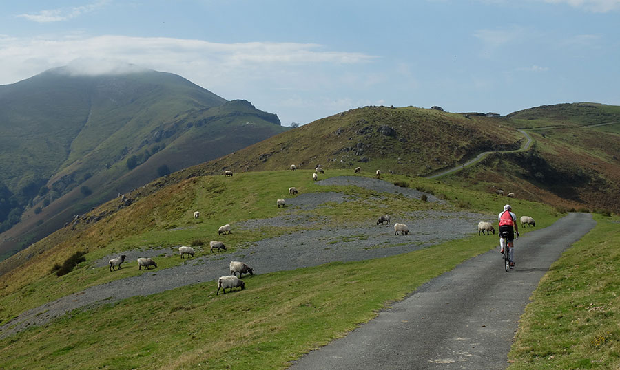
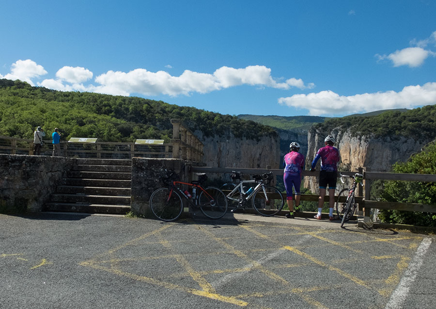
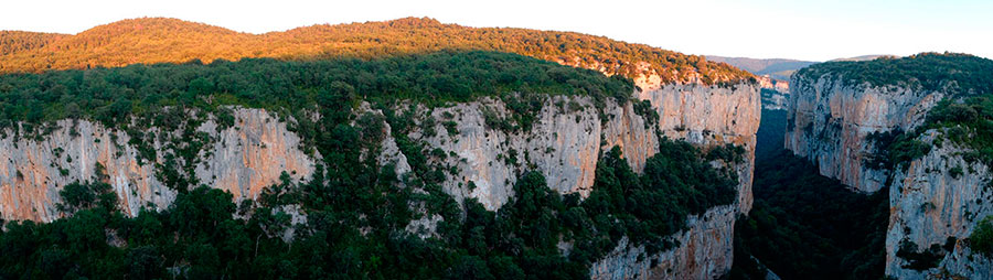
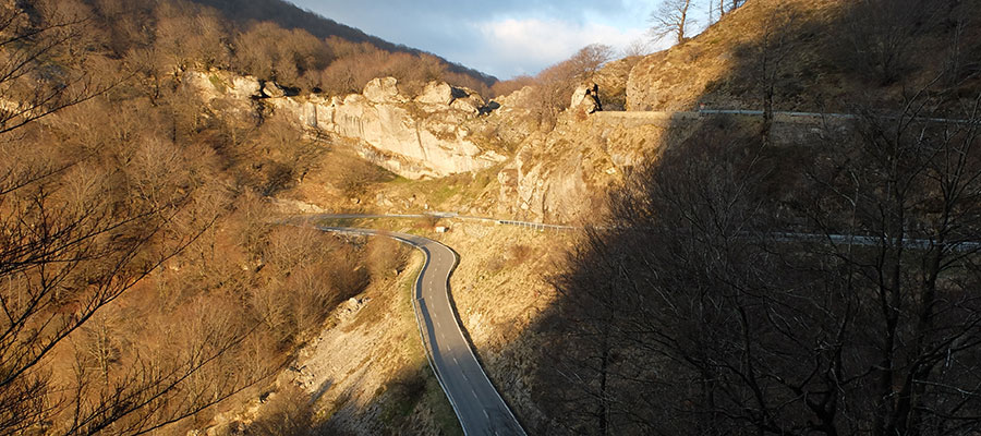
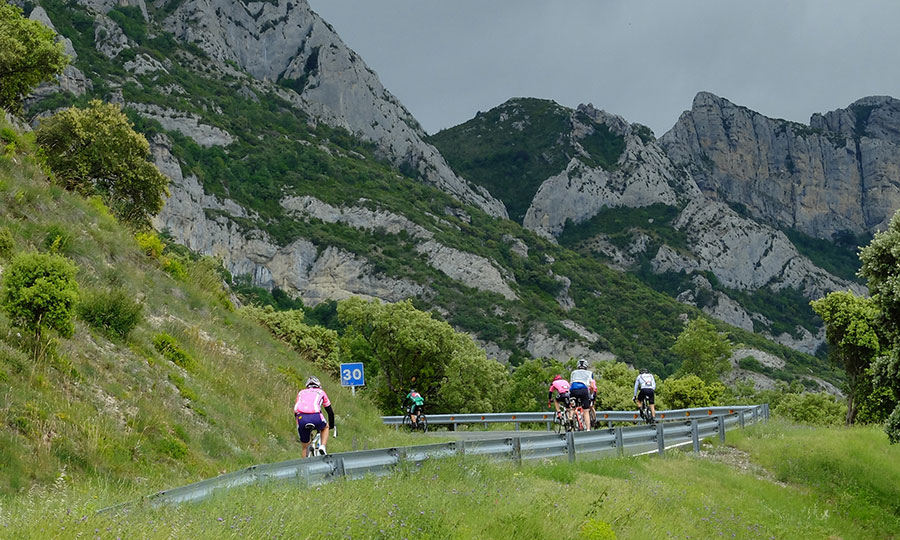
Navarra North - Pyrenees and Mythical Ports
The photos that you can see below reveal the type of terrain and the ports that we find when the STAGE stages are developed by NAVARRA North.
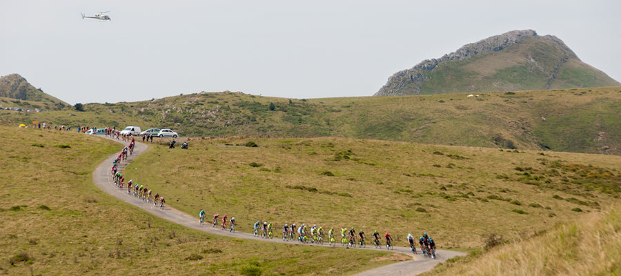
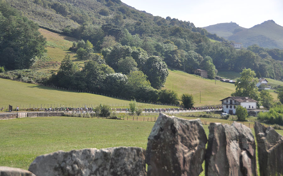
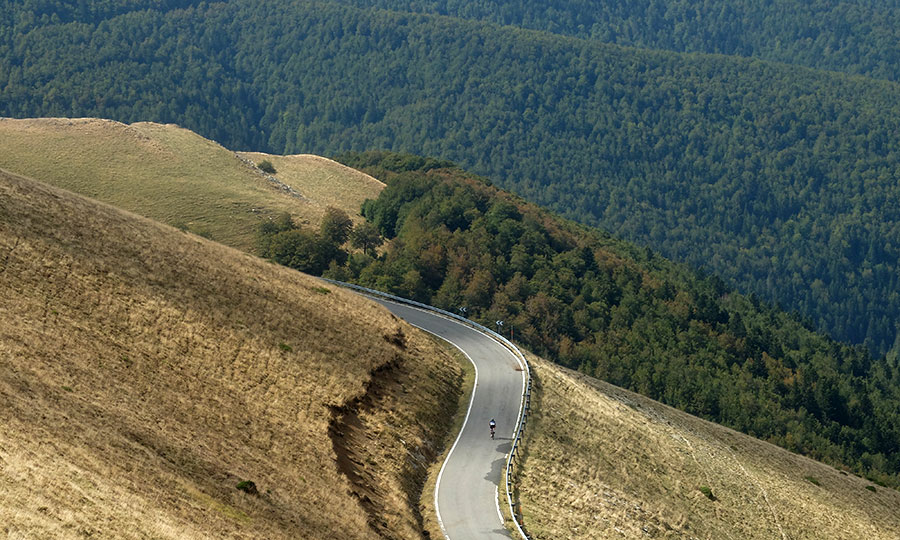
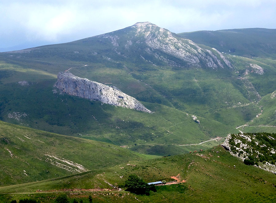
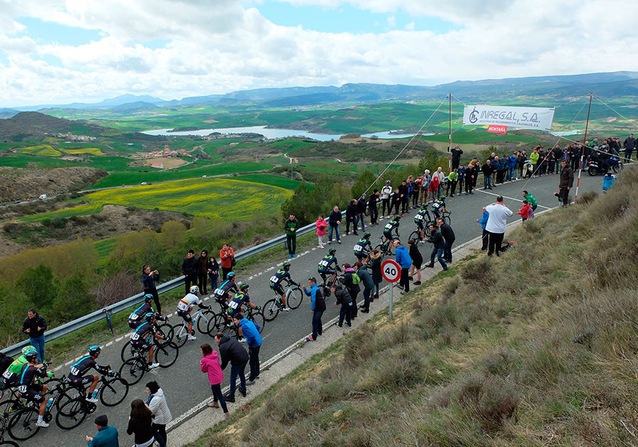
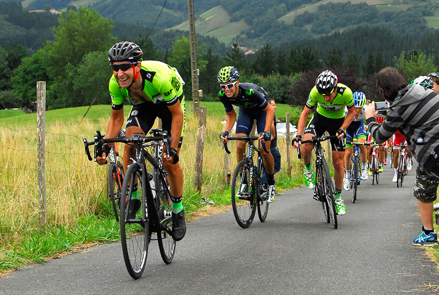
The conglomerate of routes - 7 different ascents - culminating in La Pierre Saint Martin or Portillo de Ernaz, added to the great unevenness that we must overcome by any of its slopes, make this colossus of 1,764 meters of altitude, one of the places of "pilgrimage" bound for the Pyrenees.
The unevenness is around 1,500 meters, and its difficulty reaches in its Issarbe option the 417 points of APM coefficient, a figure that is difficult to reach in the Pyrenees and clearly above the mythical ports of the Range - Aubisque 255, Tourmalet 342, Luz-Ardiden 233-
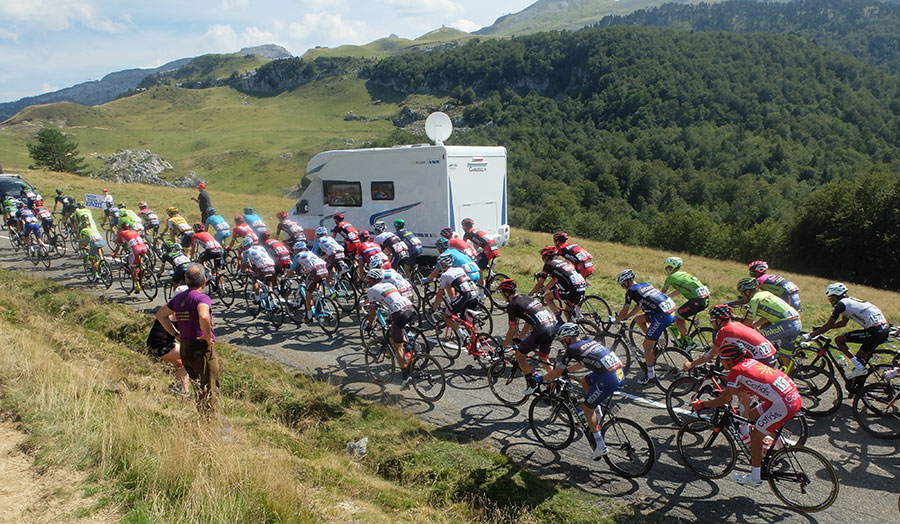
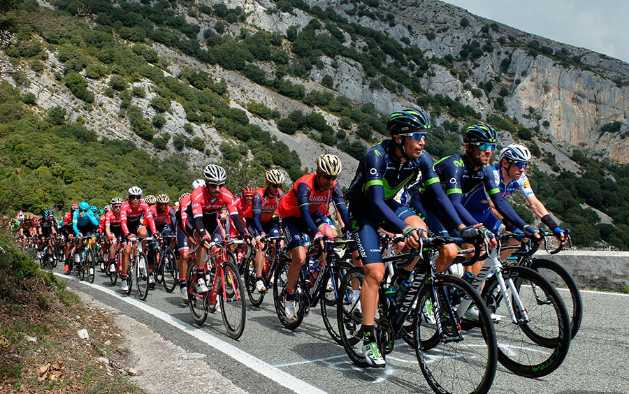
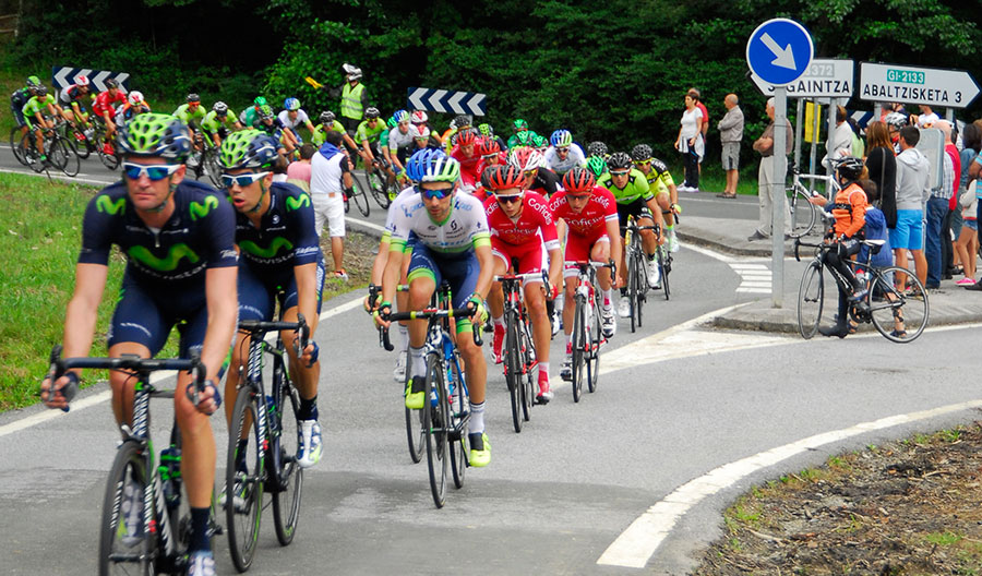
In the picture above, the pelotón of La Vuelta a España 2016 ascends along the Saint Engrace slope to what is to be called Col de Soudet, one of the intermediate points of the port between the town of Arette and the ski resort of the same name. It was also in this place where it finished the 10th stage of the Tour de France 2015 in which Chris Froome gave "the coup at the table" overthrowing his rivals. This finally allowed him to win that edition of the French probe in which La Pierre Saint Martin was consolidated as Port TOUR.
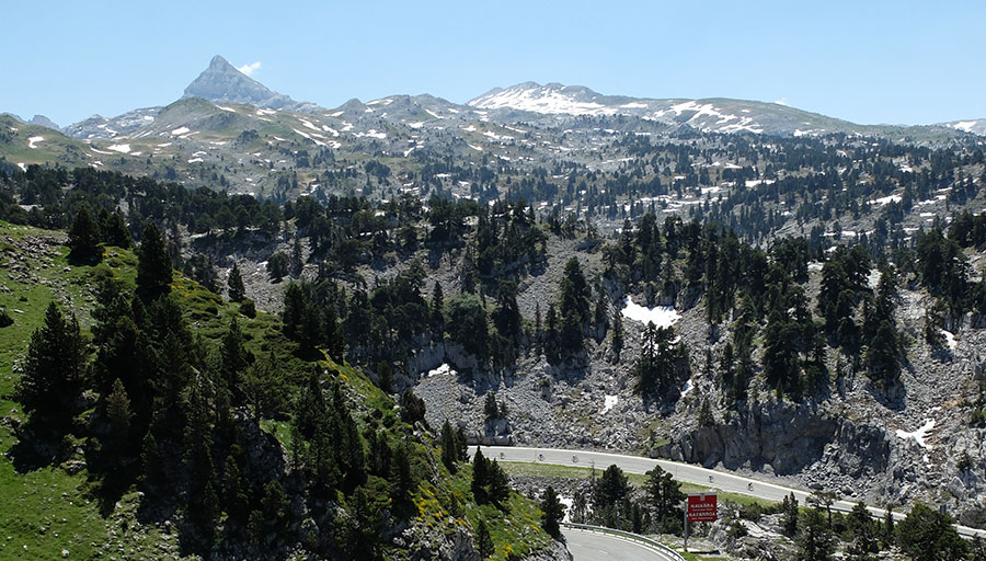
In the bottom photo the Pic de Anie watches the cyclists that cross the Karst de Larra on their descent towards Belagua and Isaba during the celebration of the probe Pax Avant 2013.
In our STAGE we usually try to make some combination of routes that includes the ascent to this colossus, such as the Isaba-Issarbe, or the route inverse of the popular Larra-Larrau.
The Astakarri mountain pass communicates the northern and southern slopes of the Pyrenees through the Sorogain area. The Navarrese towns of the southern slope of the Pyrenees - Erro, Mezkiritz, Espinal ... - link in this way with the Alduides Valley in the North.
Its location in the central part of the Navarrese Pyrenees and the proximity of other ports like Lindux and Urkiaga allows the design of routes of exceptional category with differents unevenness and kilometers.
In the image, the "wall of Sorogain", 500 meter section in which the inclinometer oscillates between 14 and 20%.
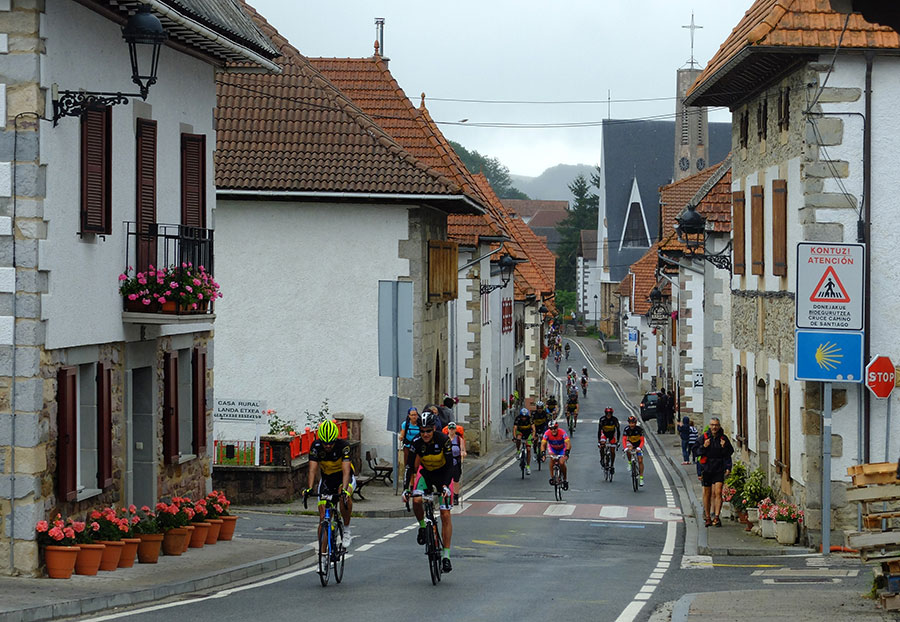
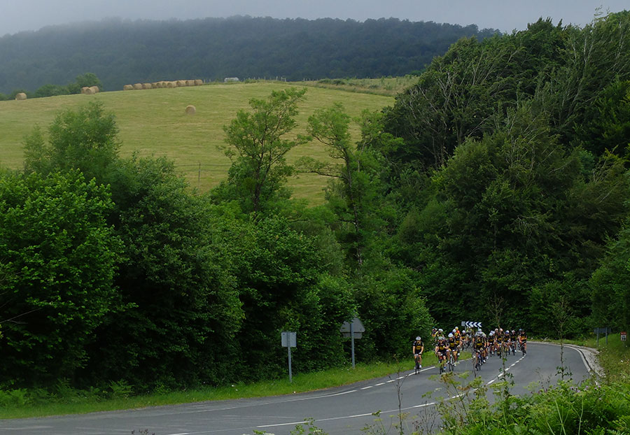
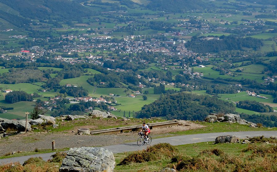
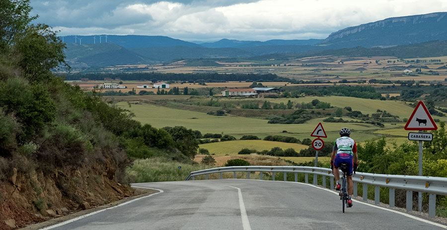
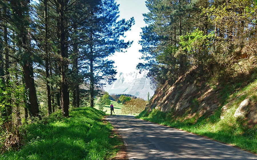
The Southern slope of the Navarrese PYRENEES in its central zone is the one that agglutinates the majority of the kilometers of the popular cicloturista probe "La Indurain". It is a friendly geography in which there are ports of little difficulty, Erro, Mezkiritz, Lapitzea, Igoli... with numerous villages of particular architecture. In much of the territory leaves its imprint the Camino de Santiago, reason why in many sections we pedal parallel to the path in which the pilgrims form part of the landscape.
Its proximity to Pamplona makes it an ideal setting for non-demanding routes. In other cases it will be the place of passage that we will face to finish the great circular routes that combine the ports of the northern slope starting from the South.
La Indurain 2016
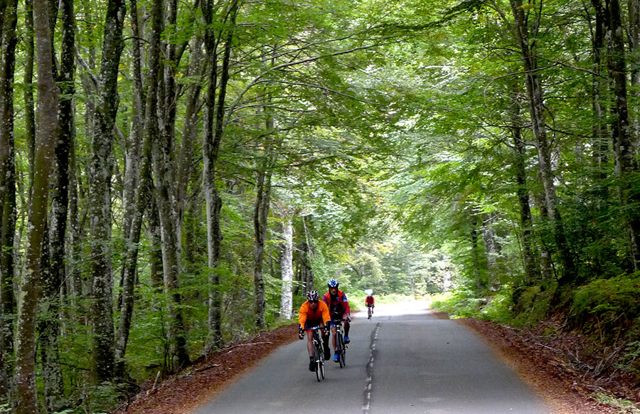
Pedaling along the northern slope of the Irati Forest after having climbed the 970 meters of Artaburu / Errozate, automatically places us in the "Top Ten" of the quality of the routes of the mountain range. In addition, if we are going to continue searching the ports of Bagargi and Larrau, we know that we are talking about Irati Extrem.
The atmosphere is just perfect. In our Stages we will use our "strategy" of taxibikes to, if we wish, to make shorter sections of the route.
Irati Extrem 2013
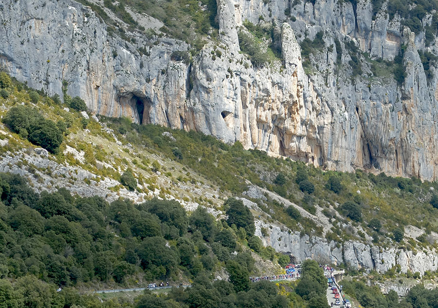
The Col de Inharpu, in Los Arbailles massif, was presented "in society" as an aperitif in the Queen Stage of the Vuelta a España 2016. That stage was followed by Soudet - by Saint Engrace - Marie Blanque and Aubisque . For "script needs" the organizers omitted that this first unknown port equaled in hardness (254 APM points in 10 km) to the mythical Aubisque (255 APM points in 17 km) to which they granted a "Special Category" that denied the other ports of the stage. Especially punished was the Soudet, who with his 327 APM points cried with his qualification of "First category Mountain Pass" when he was the King of the day. All this is pure cyclist anecdote, but it puts us on notice of - in what territory we move -
The number of roads in the massif generates 4 different routes that end at nearby points with different toponyms, Aphanize, Landerre, Inharpu... Or commonly and generalizing; Auski, toponym this that in property corresponds to the Spa of that name located in the vicinity. This amalgam of geographical points generates an unusual scenario in which once the port has passed, for a long time we pedal on the top of the Massif de Los Arbailles while we look for the point that we have chosen to descend. A territory 5 stars that it is difficult to find in the world of cycling. We always try, in one way or another, to include it in our Stages.
In the photographs, Sky controls the peloton ahead of "the roosters" of that edition of the test; Of white Froome, of green Valverde, of red Quintana and behind and of yellow the Tinkoff Team in which that year militated Alberto Contador.
The road leading to the Col de Urdanzia - inferior picture - communicates "by the hard", Saint Etienne de Baigorri in the La Nive basin with the road that connects Saint Jean Pied de Port and Roncesvalles through the Roncesvalles Gorge.
In the cyclotourist world this port is known, or rather "little known" as Munhoa, toponym this belonging to the hillside by which the road transits in the point of maximum altitude - 910 meters - that does not correspond with the hill properly said. Its "at least" 5 different ascents oscillate between hard and very hard, with an unevenness of 750 meters and many sections with two-digit percentages.
By any of its slopes the road rises spectacularly on the domesticated grasslands of Lower Navarre. With almost testimonial traffic and an atmosphere like the two photographs reflect, their inclusion in the Stages ensures the smiles at the end of the day.
The Izpegi Col, border crossing between France and Spain, is doubly bordered by the change that takes place when passing from the gentle hills of the Baztan in its west slope to the dramatic and spectacular slopes of its eastern slope, which we see In the photography. At the top - to the right - you can see the passage and the road that begins to descend to Saint Etienne de Baigorri.
The strategic location of the port - at the point where the Pyrenees begin to smell of the sea - and its combination with other nearby ports like Otsondo and Artesiaga allows us to combine it with routes of all levels.
The Northernmost part of Navarre is often the warmest. The proximity to the sea and its low altitude are responsible for this microclimate. From the immediate heights to Zugarramurdi the Pyrenees continues to sink into the Gulf of Bizkaia, creating in its progress a series of steps that we take advantage of for develop our tours, Otsondo, Urbia, Lizuniaga, Ibardin... when we look for smooth routes. Artzamendi, by Mondarrain - as we like it most - one of the hardest ports of the Pyrenees, Bagordi, Baigura... if the thing goes "hard".
In the images, the Gulf of Bizkaia from the top of Artzamendi, encounter on the ramps of Baigura and the pelotón of La Vuelta a España 2016 between Zugarramurdi and Dantzarienea.
Located between the Basque French provinces of Lower Navarre and Mauléon, the Arbailles massif takes off slightly towards the North of the central axis of the Pyrenean mountain range.
The passage that crosses the massif by road is known in the cycling environment as Auski. With its 4 demanding ascents - all of them around 800 meters of unevenness - and its beauty 5 stars, has become one of our recurring destinations. The image corresponds to the slope by which it was announced in La Vuelta a España 2016.
In the westernmost area of Northern Navarre, in the Sierra de Aralar, the Artxueta mountain and the San Miguel, Sanctuary , stand as the representatives of difficult cycling in the area. If we want hard route we include the ascent from Uharte Arakil, if we want to smooth we climb from Lekunberri. A safe value on any Stage.
Converted into TOUR port for its 2 career inclusions -1996 and 2007- Larrau never ceases to be the object of desire. Its numbers speak clearly, 1200 meters of unevenness and 369 APM points, In addition to their hardness, they push in their favor the beauty and scarcity of traffic on their asphalt. In this sense we could speak of a ratio of 1 to 100 compared to the mythical central ports of the Pyrenean mountain range. Given its location in relation to Pamplona, its inclusion in routes always requires combining it with some other port, so that the options to ascend it always find demanding routes. In our Stages we look for different formulas to ascend it, from the standard routes of the Larra Larrau but starting in Otsagi instead of in Isaba, until harder and unknown routes like the Challenge of WAITING FOR GODOT.
Larra-Larrau 2016
The various roads that cross the northern slopes of La Selva de Irati come together in the place known as Chalets de Irati or Bagargi. The port has three slopes, all spectacular but none easy. By the west we will have to climb first Artaburu or Burdinkurutzeta - both biggest words -, by the north we will face Ahuski by one of its 4 slopes - all of them hard - before approaching the spectacular cresterio that from the spa of Ahuski and the Col de Burdin Olatze leads to the top (photo 1). To the east, from Laugibar and by the town of Larrau; (Second photograph) an authentic port TOUR, promoted in the 16th stage of the 2003 edition - after the Soudet - on its route between Pau and Bayonne. Again the numbers do not cheat, 326 APM points and several kilometers with slopes above 10% on average.
By the North option ascend PYRENEIST and BASOAK, the route by stages of 4 days that runs through the North of Navarre.
As in other situations and since Bagargi is not very close from Pamplona, our Taxibike strategy allows us to access this port without having to carry out a very hard stage.
The port of Urkiaga is the most obvious pass between the 2 sides of the Pyrenees if from Pamplona we draw a straight line towards France. In its North slope, between the towns and farmhouses of Esnazu, Aldudes, Banka, Urepel...we find a world "apart", visually idyllic. The best known route is the main road, - starting at Aldudes and passing through Esnazu - but the geographical complexity generates at least 3 other ascents, one more from Aldudes and two from nearby Urepel. All these routes converge in the Col de Enazu or Baztan Benta at 755 meters of altitude, where we can say that we have already made the most difficult, but from where we still have 6 kilometers before reaching the 911m quote that marks the end.
In any of the ascents the atmosphere remains idyllic but absolutely lacking in "traps" in the form of ramps. In some routes we will touch up to some 20% and in all will be frequent exceed 15% in many occasions.
In photo 1, place called Col de Garzéla where one of the routes links to the main road. In photo 2, Overflowing Nature in the hard ramp that takes us out of the Col de Paradar, intermediate point in 2 of the options.
From up or down, by one slope or by another, It will be rare for us not to cross the Port of Urkiaga.

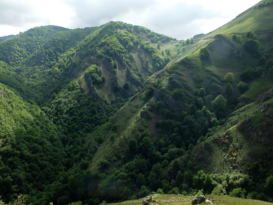
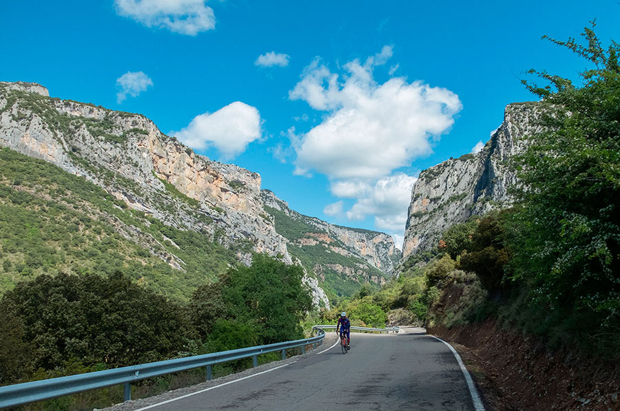
Sometimes a cloud clings to the border line as if it knew politics and forces us to stay on the southern slope of the Pyrenean chain. It is time to "put the wheels" on the South of Larrau and back where we have gone. If the north side of the landscape is abrupt and even aggressive, the southern slope is just the opposite, gentle and soft, although it is not a walk either. It is the moment to appreciate the exuberant totality of La Selva de Irati which is at our feet during much of the ascent. It is also the moment to appreciate the own character and the striking architecture of the Navarrese towns in this part of the Pyrenees.
In the photographs, Viewpoint on the Pyrenees, Otsagi and the Selva de Irati during the descent of Larrau.
The Pyrenees slopes of the Community of Iparralde hide many surprises, traps we could say, incredible walls which at times and to the surprise of the cyclist have an asphalt as if they were prepared to receive a stage of the Tour de France the next day. This is the case of Urrizpilota, a major port of 6.3 km and 670 meters of unevenness (10.6%), in which the "final highlight" - from the point where the photo shows the cyclist to the top - puts us in front of a wall of 2 kilometers to 15.2%. All this in an overflowing scene that as usual is appreciated from above or during the descent.
In the immediate vicinity, the neighbor Ixtauz offers us numbers even higher, 6.3 kilometers to 12%. In our Stages this field of play is used exclusively for the fans of the Mountain Passes or for those who want to test how they will go in their next Angliru.
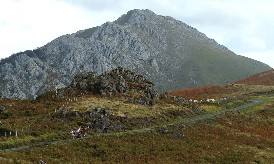
We have left for the end of this chapter of Navarre North what may be considered King of the Kingdom. With its 5 different main ascents, all of them around 1000 meters of unevenness, the arnostegi Col begins to stop being a great stranger and begins to occupy its preferred place.
Its simplest route - from Esterenzubi, where we descend - has a coefficient of 268 APM points - Aubisque 255 - and the most demanding - by which we ascend - the known as Arnostegi by Bellurti reaches 385, points these of which 358 Have been achieved in just 7 kilometers - Tourmalet 342 in 23 kilometers - If we prefer "less hard" alternatives we can choose the option by Ondarolle -288 points- which although it is still demanding, is more "human".
This is the general tone; Points that are obtained essentially due to the high percentages of their pending and not so much because the mileage is excessive. That said we must add the good things ... to the usual in these lands of the almost testimonial traffic must be added simply that of a beauty that sometimes short breath - in case we did not have enough with the slope -
In some section we will coincide with pilgrims who often have the property to offer us unusual images, in others the view will stop on the natural walls of the pre-Roman fortress of Zerkupe ... always above us, in the vicinity of the Col, the Roman Tower of Urkulu ... shepherd's cabins everywhere ...
Anyway! Bucolismo at the end of the Slope, that's what we have.
Navarra Media - Castles, Monasteries, Banks and Inner Sierras
The photos that you can see below reveal the type of terrain that we find when the STAGE stages are developed by NAVARRA Media.
We could say that the Port of Etxauri is the prototype Col in the Middle Zone. 6,8 km of route, 430 meters of unevenness, sun and shade in equal parts and excellent viewpoints of a good part of NAVARRA and the neighboring Communities. Being located directly above the Pamplona Basin, and the spectacular surroundings with the road under the walls of the climbing school, is what makes this port be present in most of the routes west of PAMPLONA.
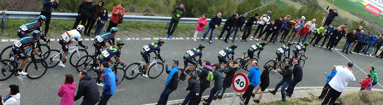
In the photographs the peloton of the Euskal Itzulia 2017 ascends under the cliffs of the port. In the foreground Movistar, with the final winner of that edition of the event - Alejandro Valverde - in the front, approaches the top well guarded by the Trek-Segafredo of Alberto Contador.
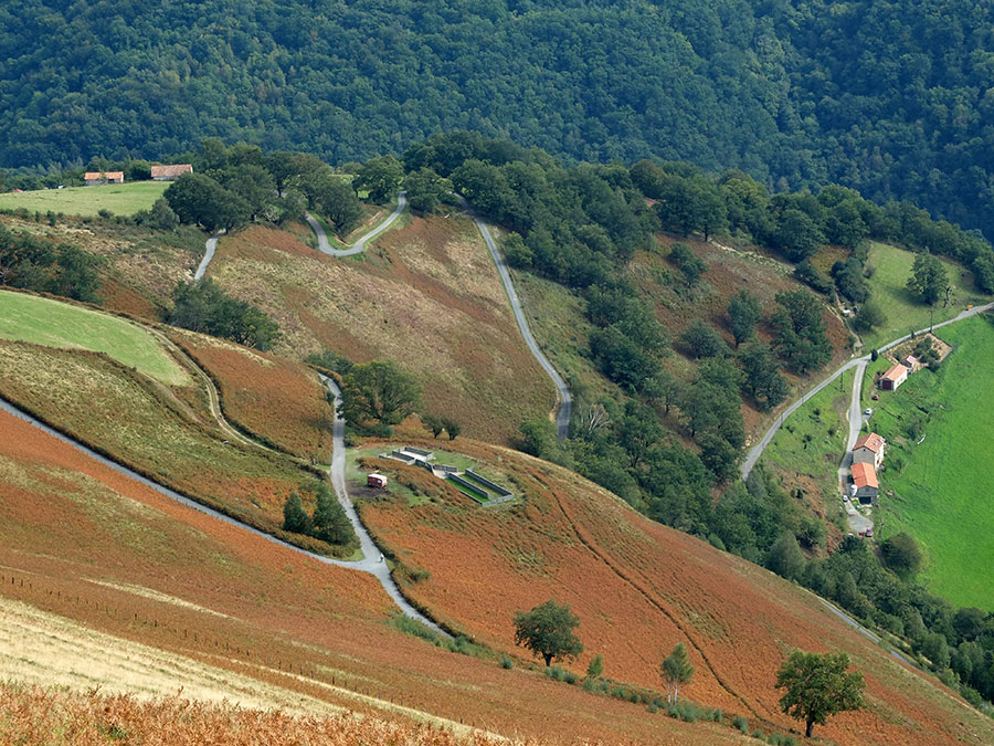
At the eastern end of the Community, in the Prepirineo Navarro, the rivers that descend from the mountain range have generated a network of foces; Lumbier, Arbaiun, Pandelo, Benasa, Ugarrón... Between them a spectacular geography emerges. Geography that in some cases allows to be crossed on two wheels and that gives rise to routes of all the levels of difficulty.
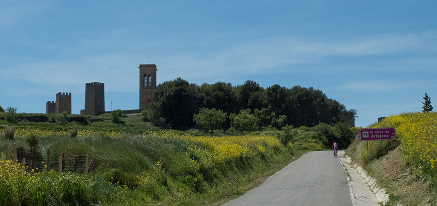
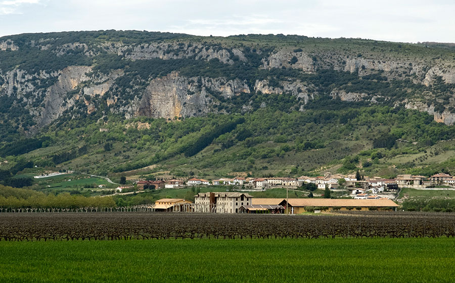
Sometimes it will hardly be necessary to move from PAMPLONA to get to pedal, this is what happens to us in the territory where it is developed annually the Cycling Tour Los Muros del Minero. In this geography located to the west of the capital, we alternate peculiar landscapes that bring us to the present the echoes of the mining activity that was developed in this region, (photo 2) and villas impregnated with atmosphere medieval. The maximum exponent of this last one is manifested in the impressive walled complex known as Cerco de Artajona (photo 1), a place ideally located to realize one of our refreshments stations.
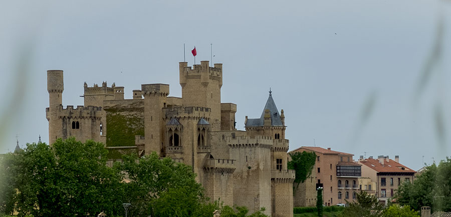

Directly to the south of PAMPLONA, in the "Zero Zone" of NAVARRA Media, we find a region that could well be said to be "saturated with Navarra". We will have to choose, because if we stop at all points that deserve to stop we will not find the "pedal stroke" to end the proposed route.
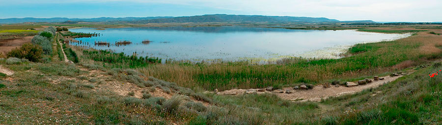
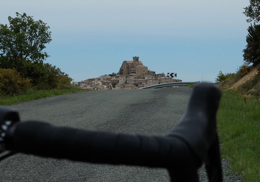
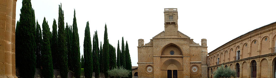
In a typical route of ... say 70 kilometers, we can find: The Castle and Medieval Villa of Olite -as in the stories- (photo 1), the Lagunas de Pitillas - stop place of thousands of migratory birds - (photo 2), the excavations of the Roman City of Cara in Santacara, Ujue, which emerges as a lighthouse with its striking church / fortress and historic center - a potent combination that has allowed it to become part of the list of "Most beautiful towns of Spain" (photo 3), San Martín de Unx with its universe of wines, vineyards and wineries, the Monasterio de la Oliva -visitable if your schedule does not match the rest of the monks- (photo 4), the Despoblado de Rada - abandoned 550 years ago -
In short ... "Saturation of Navarre" in a radius of 25 kilometers. In the last image, last weekly market place in Ujue, characteristic landscape in our passage through the high points of the Middle Zone - with the PYRENEES at the bottom-
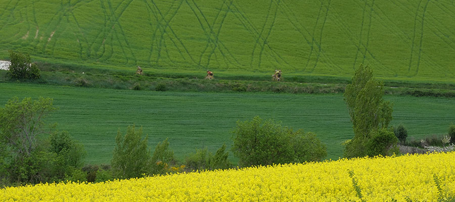
To the west of the capital, the Pamplona Basin shows a gentle terrain that allows you to choose between a tranquil roll between crops, sunflowers and vineyards - such as the Señorío de Otazu - (photo 1) in the Etxauri Valley or ascend to the more dificults ports surrounding the basin.
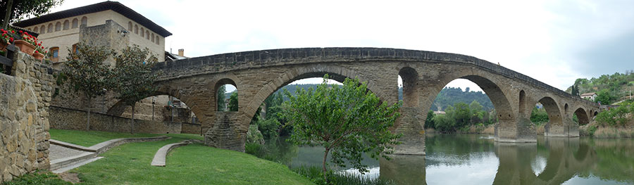
The medieval village of Puente La Reina with its impressive seven-arched Romanesque bridge over the river Arga has become an unbeatable spot to enjoy the history of NAVARRA in everything related to the Camino de Santiago.
We choose; Or we pedal by simple routes wrapping along parallel and calm roads the Jacobean route and the pilgrims that transit through it, or we incorporate to the same and taking advantage of our taxibike logistics we realized a stage in line of Camino de Santiago until Logroño or even beyond.
In the image, Movistar and Sky fight for the control of the race in Alto de Guirgillano, in the neighborhood of Puente La Reina.
Grand Prix Indurain 2017
Tierra Estella is among many other things, traditional cycling land, in this sense, one of its greatest exponents is the professional race "Grand Prix Indurain" held annually on its roads. It also possesses a kind of microclimate that sometimes makes us look at their possibilities when there are doubts over time.
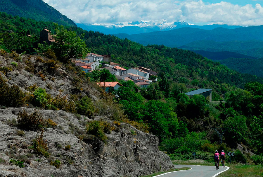
The routes that start in Estella, can take us to La Rioja, to the Montaña Alavesa, to the banks of the Ebro or to the northern ranges and ports of - Lizarraga, Urbasa, Opakua -
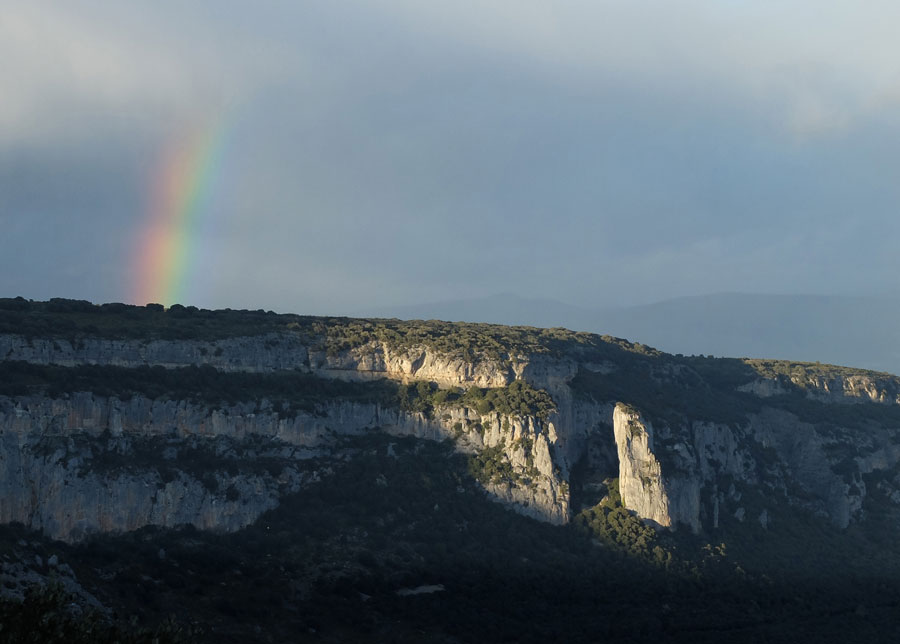
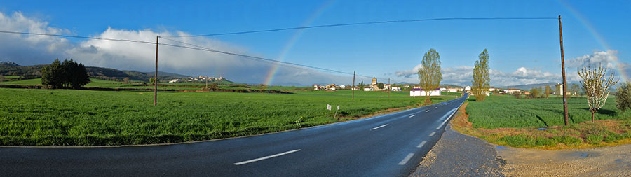
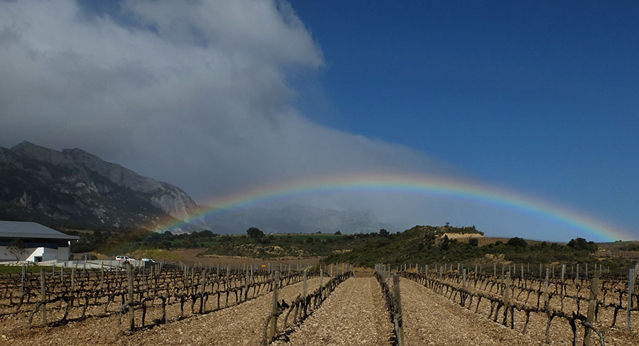
The geography is gentle but not free of "traps" and often with constant ups and downs. In the images, spring rainbow in the environs of Aritzala and broken race in the descent of the Col of Eraul towards Abartzuza during the edition of Grand Prix Indurain 2017. In front Simon Yates raced towards the goal in the Puy of Estella.
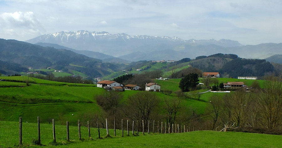
In the northwest end of the Community, halfway between Navarra North and The Middle Zone is the Sakana Valley. Encased between the Sierras de Aralar and Aizkorri in the North, and Andia, Urbasa and Entzia in the South, it offers us excellent kilometers when we want to realize great distances without ports, even more if we combine it with its natural geographical continuity that is the Llanada Alavesa. That allows us to have more than 60 linear kilometers in which to roll by quiet roads (the traffic is diverted by the highway). If we change our mind, we only have to twist the handlebar to meet the ports that in the north and the south allow to leave the valley, Zuazarrate, San Miguel de Aralar, Opakua, and especially the more specifically "Sakanensis" Lizarraga and Urbasa, ports with a flavor of classic cycling.
In the images, road with wide and smooth curves in Urbasa (photo 1), a rock formation known as Las Dos hermanas, at the eastern end of the valley (photo 2) and Goñi highland on the southern slope of the Andia mountain range. We frequently visit this place when making combinations with ports from the valley (photo 3).
Navarra Peripheral - Expanding Diversity
The territorial distances of NAVARRA allow us to "put the wheels" in the surrounding territories. If the Community is already diverse, these incursions in the periphery contribute a value to the set that can be verified by just reviewing the images that we put below.
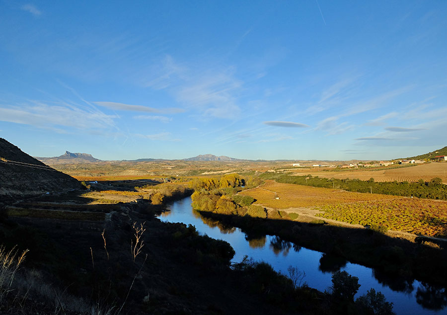
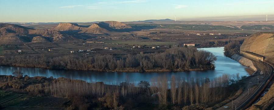
The Ebro River Bank has developed an environment of common culture around the river. We alternate between La Rioja, Alava and Navarra, the Ebro is the same; Crops, vineyards, orchards, poplars ...
The river is wide, there are no bridges at any time, sometimes we feel isolated ... and we are next to the "Iber", Roman name of the river that ended up identifying the entire Iberian Peninsula. We like to pedal along the Ebro.
In the pictures; Logrono with the Sierra de Cantabria on the horizon (photo 1), La Vuelta a La Rioja 2017 crossing the river in Lapuebla de Labarca (photo 2), the Castle of Davalillo watching over the vineyards and the ford that allows the passage of the river at that point (photo 3), and riverbank landscape between Alcanadre and Lodosa (photo 4).
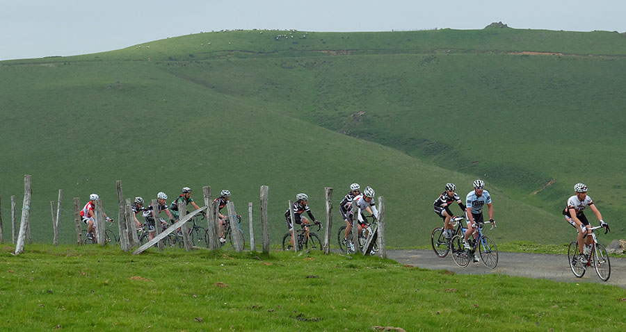
The Sierra de Aralar is shared between Gipuzkoa and Navarra. The massif has dimensions that allow to carry out routes of a certain extent by its perimeter. It is not excessive but considerable, since we speak of a minimum that exceeds slightly the 100 kilometers.
It is what we call the Aralar Tour a route with many options and a very different environment depending on the slope that we are traveling. In the south - Navarra - uniform and predictable roads and landscape, in the north - on the Gipuzkoa slope - an infinite number of small roads, constant ups and downs between farmhouses and small mountain villages, intense Lizarrusti forest on the western slope, and Gipuzkoa Industrial present but without high interference on route.
We are talking about routes with classic scents which run precisely for a territory in which they abound and that is "seat" of one of the greatest fan group in the world, the Basque fans, that is always present in the ditches of all the great cycling races.
At its westernmost point NAVARRE touchs with Alava in the "Cuadrilla" - region - of the Montaña Alavesa. With regard to cycling, we can define it as a group of small villages overflowing with authenticity with intercalated natural spaces that follow each other regularly and wide enough to allow any type of itinerary.
In the pictures; Daily environment in any of the routes of the area, pedaling between the beechs (photo 1), and La Muela de San Román (photo 2) on the village of the same name, forests and crops in equal parts.

Although it is not usual, some times what we want cyclists is to face us as hard as we put ahead. For these cases we keep the Diablillos Vascos.
In the second photograph we have one of the TOPs TEN of the area, the fearsome "Gaintza Wall" - 1,6 kilometers at 15,3% - where Alberto Contador sentenced his Vuelta to the Basque Country 2014. In the first photograph we descend Lazkaomendi with the view set in the ascent to Usurbe, - the mount with the antenna in the top - the absolute TOP TEN of the zone and whose hardness we accustom to simplify simply saying that its wall comes to be like "Half of the ANGLIRU".
The Aragonese Pre-Pyrenees has always captivated us. Its limits with NAVARRA are capricious, and if it were not for the information panels and for the differences in the asphalt little relevance would have to be on one side that the other. It does not take much taxibike ride to roll through this rough terrain, barely populated and overwhelming.
In the first photograph we cross the gorge of the Foz de Burgi, on the border with Zaragoza, in the second, we approach Castillonuevo. On the horizon the Collarada massif.
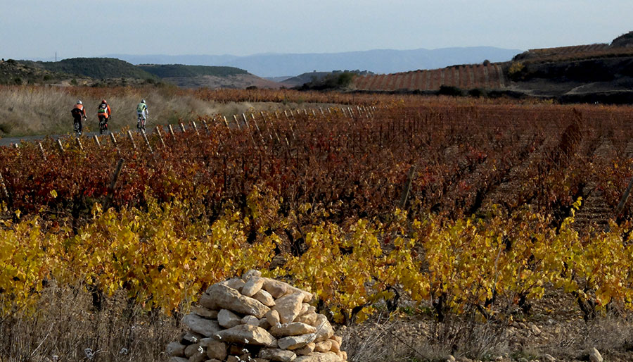
The proximity of the wine region of La Rioja and the very existence of the Rioja Navarra translates into an irresistible attraction - ¿Why resist? - to roll between vineyards. We will not regret, knowing how to choose, the territory offers countless roads that sometimes do not appear on the maps and that give rise to routes that at least we can call "glamorous".
In the first image the new facilities of Bodegas Rothschild Vega-Sicilia under the Sierra de Cantabría in the Alava village of Samaniego. On these lines pedaling between the vineyards of the Marqués de Riscal winery in Elciego, behind the charismatic building designed by Frank Gehry.

The boundaries with Aragon in the southwest of Navarre coincide with the territory known as the region of Las Cinco Villas. It is an extensive and largely uninhabited space but with a few Villas such as Sos del Rey Católico or Uncastillo - just to name a few - who claim almost "brutally" (6 churches and 1 castle only in Uncastillo) their recognition as fundamental entities to have in account in the history of Spain and Europe.
In the world of cyclotourism is Rompepiernas territory, so much for what makes with our legs the territory in question as for the name of the Cycling Tour that is realized by its solitary roads.
In the images, around Sos del Rey Católico (photos 1 and 2) and arrival in Petilla de Aragón, a corner of NAVARRA that by avatars of history is completely "surrounded by Aragon."
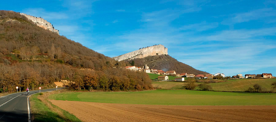
The sierra de Cantabria extends along Burgos, Rioja, Alava and Navarre lands. Approaching in a vehicle to its easternmost slope the possibilities to roll are for all tastes, but often the mobile to get closer to it - separate vineyards - is the Col of Herrera, (photo 2) ascension that we will combine with other nearby mountain pass like Rivas de Tereso or La Aldea to complete routes in an environment that surprises - perhaps unexpectedly - by its wild character.
Cicloturista Vitoria 2016
One of the options that most diversity contributes to a Stage is to travel in taxibike to the Valley of La Sakana in the northwest of NAVARRA and from there roll to the North towards Gipuzkoa, towards what the industrialists of the district have agreed to promote internationally like Goierri Valley.
The routes are developed along the low slopes of the Aizkorri and Aralar ranges and by a mixed agricultural / industrial territory with a strong imprint of mining past.
The routes are always alive and changing; A stretch of forest, a small port between hamlets, a ratonero descent, we circled a locality of a certain entity ... and again up by another ramp. Aroma and flavor of classic, Tour to the Basque Country, which is quite logical being as we are in the heart of the core ... it is rare the year that the Basque round does not go down these roads.
We could think that traffic can be a problem in this geography, but the reality is that the highways absorb the circulation.
In the images, stop at the Alto de Barbari between Segura and Zegama (photo 1), typical landscape of the agricultural Gipuzkoa - with the Aizkorri mountain range on the horizon - (photo 2) and Medieval farmhouse in Zerain (photo 3).
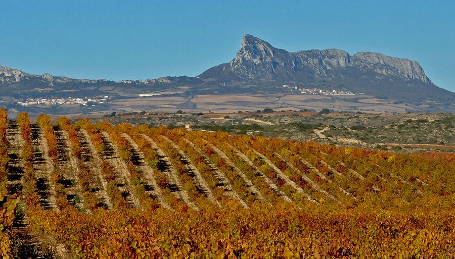
In Autumn it will be difficult not to "sin" and choose as destination what some call "La Toscana Riojana". When it is the case, to that day of the Stage we call Autumn Vineyards.
At the summit where Navarre, La Rioja and the Basque Country converge (photo 1) we find "The Sleeping Lion" - the rocky formation to the right of the photograph - and to his left the Port of La Aldea that communicates with the Montaña Alavesa. It is a perfect playing ground for quiet walks observing the intense red of the vineyards and making visits to wineries and stops in villages that never cease to amaze like this walled village of Labraza (photo 3).
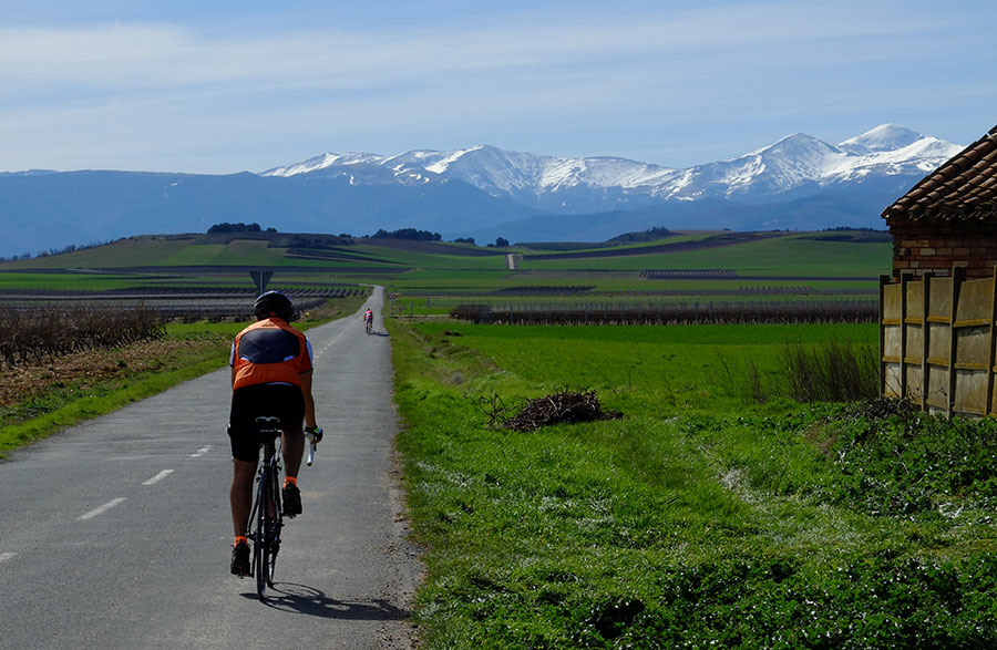
And when the season seemed to be over, there are still days that allow us - forgeting ports and highlands - to continue with "what is ours" and to roll in a suggestive environment that we call Winter Vineyards. Without pretentions and guarded by snowy mountains like these from the Sierra de La Demanda
PRICES and OPTIONS of -VIP- STAGES PAMPLONA - PYRENEES
Alma Pamplona 4* - 4 Stages / 5 Nights 5.390 € - 4.690 €
Alma Pamplona 4* - 6 Stages / 7 Nights 7.410 € - 6.240 €