ASFPALT
moderate

Distance: 95km Unevenness: 1950m
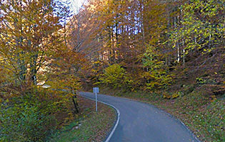
Return tour which takes place entirely through the southern slopes of the Pyrenees between Isaba and the forest of Irati.
Between the valleys of Roncal and Salazar, classic Navarre Pyrenees middle mountain terrain, Oaks, beeches, wild firs, rocks...
Although on the map does not seem so attractive, in practice a return tour does not require repeating a single kilometer, as both the profile and the landscape from the perspective of the cyclist, can be completely different in one direction or another. It's what happens in this route that runs between the Roncal Valley and the forest of Irati.
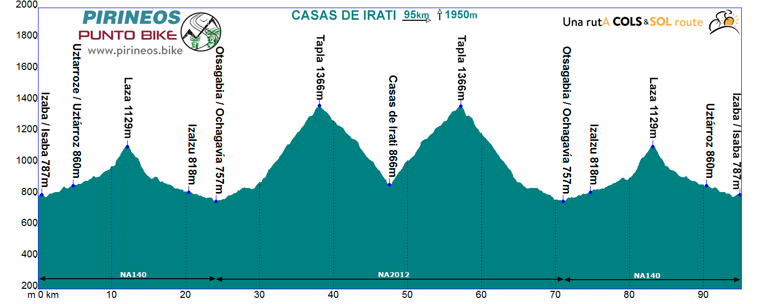
Itinerarie: Isaba NA140 - Uztarroz - Pto. de Laza - Izalzu - Ochagavía NA2012 - Pto. de Tapla - Casas de Irati - Pto. de Tapla - Ochagavía NA140 - Izalzu - Pto. de Laza - Uztárroz - Isaba
If you want to see the route on wikiloc website click on the green icon on the map.
we are working in this web
Terreno inicialmente en ligero ascenso, con una dificultad final de 2 km al 7% en la llegada al puerto de Laza, desde donde descendemos al valle de Salazar.
Entre Ochagavía y las Casas de Irati, terreno más exigente y despejado para atravesar el paso de Tapla, punto culminante del recorrido (1368 m) antes de dejarnos caer entre las hayas a las Casas de Irati. 14 km con un muro de 8 km al 6% en la ascensión por la vertiente sur y 9,5 km muy uniformes al 5,5% cuando remontemos lo antes descendido entre hayas.
Tras descender Tapla y kilómetros aparte, solo nos quedará un esfuerzo más en los 3 km al 6,5% de la vertiente oeste del puerto de Laza, antes de dejarnos ir hasta Isaba.
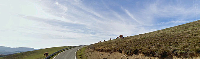
We are where we are, in the Atlantic Pyrenees, with a plain to the North with localities at very low altitude and ports that are close to the 2000m range.
The southern slope is more "human", towns are in a higher altitude and the slopes are not so important.
The vast majority of the routes cover the ports of the "greats": Issarbe, La Piedra de St Martin, Laberouat, Bagargi, Artaburu, Arnostegi, Ahuski, Larrau...with slopes ranging between 1000 and 1700 meters. Some routes ascent one of these ports, others 2 or 3 and even more.
We anticipated this so the criteria are clear for each 6 levels that we have chosen for the ranking of the routes.
- Walks or family routes: Routes with light slopes and little travel. Suitable for untrained family groups or for people who usually don't use the bike.
- Easy: Routes with a slope that can reach 1000 meters but facing none of the large ports.
The distance will range between 40 and 60 kilometers. - Moderate: Routes with one of the "great" ports or a combination of similar difficulty. The slopes can be really important and slopes can range between 1000 and 2000 meters.
An example of "moderate" is the Artzaiak S stage through Bagargi. The port is tough, but it is the only major difficulty of the day, i.e. we have the whole day for this task, that’s why we left it in "moderate"..
The distance will vary between 60 and 100 kilometers. - Hard: Routes with a slope ranging around 2500 meters. There may have to ascend 2 ports of the "greats" or one and several of the "minor".
The distance will vary between 90 and 130 kilometers. An example of how difficult it can be, will be the short route of the well-known Larra-Larrau. - Very hard: Routes ranging from the 2500 and 4000 meters of altitude. Sometimes there may have to ascend the 3 ports of the '' greats ''. The distance will exceed the 100 kilometers and may reach the 200.
The long route of Larra-Larrau is one of the exponents of how difficult this route is. - Challenge: In these times there is a public that demands "more" yet. To them arises the concept of "challenge": stages of more than a day in "non-stop" mode, 4500-5000 or even more meters of altitude routes, individual or group time trial with 3000 meters of altitude and over 100 kilometers of route.
Finally, a variety of what riders would usually call "nonsense" which to be more elegant, here we call it, 'Challenges'.
 Return