ASFPALT
moderate

Distance: 110km Unevenness: 1840m
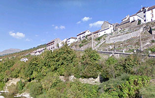
Tour that develops between the Valley of Ansó (Huesca) and the ones of Roncal and Salazar (Navarre.)
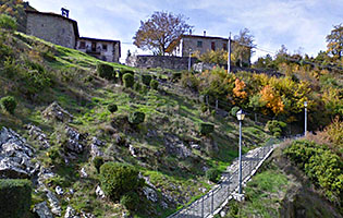
Medium mountain territory, more integrated in the Pyrenees in its first part -Belabarze, Zuriza, Ansó- and more humanized later.
The route is a combination of the itineraries "Ezkaurre 360" (that runs for the most part but in the opposite direction) and "Kakueta road" (With that we share asphalt from the moment that we find the Ezca, after getting down Matamachos.)
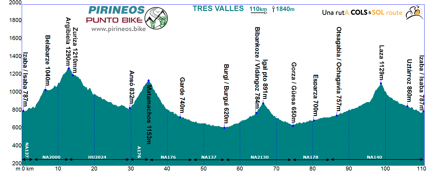
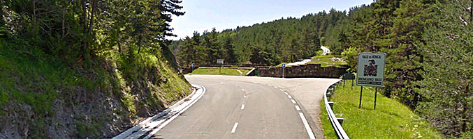
Itinerarie: Isaba NA137 - NA2000 - Pto. de Navarra - Zuriza HU2024 - Ansó A176 - Pto. Matamachos NA176 - Garde - NA137 - Burgui NA2130 - Vidángoz - Pto. Igal - Güesa NA178 - Ezcároz NA140 - Ochagavía - Pto. Laza - Isaba
If you want to see the route on wikiloc website click on the green icon on the map.
we are working in this web
Tras recorrer 3 kilómetros en ligero ascenso a la orilla del Belagua, abandonamos la carretera que nos llevaría a Arette y comenzamos el ascenso a Belabarze (3 km, 7%).
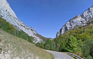
Alcanzada la altura que nos sitúa en los prados de Belabarze, llaneamos con comodidad hasta los 3 últimos kilómetros, algo más exigentes, que nos llevan al puerto de Navarra, collado éste que da paso a la provincia de Huesca y a 16 kilómetros espectaculares, rodando en constante descenso entre las paredes de la Peña de Ezkaurre y el macizo de los Alanos hasta llegar a Ansó.
Cinco kilómetros después y 300 metros más arriba habremos alcanzado la 2ª dificultad montañosa de la etapa, el puerto de Matamachos por su vertiente este. Nos despedimos aquí de las vistas hacia el Pirineo occidental y durante 20 kilómetros descendemos introduciéndonos en el valle de Roncal y alcanzando el punto más bajo de la etapa en la localidad de Burgui.
Girando casi 180 grados enfilaremos hacia el norte en constante ascenso hasta Vidángoz.
Tras remontar el puerto de Igal sin mucho esfuerzo (2 km al 5%) descenderemos hasta el Valle del Salazar, remontándolo en suave pero constante pendiente, mientras vamos atravesando numerosos pueblos típicos de la zona: Sarries, Esparza, Oronz, Escároz, Ochagavía, Izaltzu... hasta encontrarnos con el 4º alto de la vuelta, el puerto de Laza (1100 m, 3 km al 6,5%) que franquearemos para volver a pasar al valle de Roncal y atravesando Uztárroz nos pondremos de nuevo en Isaba.
Es totalmente factible plantear el itinerario en sentido inverso. No encontramos ningún razonamiento que nos haga dar preferencia a un sentido u otro.
We are where we are, in the Atlantic Pyrenees, with a plain to the North with localities at very low altitude and ports that are close to the 2000m range.
The southern slope is more "human", towns are in a higher altitude and the slopes are not so important.
The vast majority of the routes cover the ports of the "greats": Issarbe, La Piedra de St Martin, Laberouat, Bagargi, Artaburu, Arnostegi, Ahuski, Larrau...with slopes ranging between 1000 and 1700 meters. Some routes ascent one of these ports, others 2 or 3 and even more.
We anticipated this so the criteria are clear for each 6 levels that we have chosen for the ranking of the routes.
- Walks or family routes: Routes with light slopes and little travel. Suitable for untrained family groups or for people who usually don't use the bike.
- Easy: Routes with a slope that can reach 1000 meters but facing none of the large ports.
The distance will range between 40 and 60 kilometers. - Moderate: Routes with one of the "great" ports or a combination of similar difficulty. The slopes can be really important and slopes can range between 1000 and 2000 meters.
An example of "moderate" is the Artzaiak S stage through Bagargi. The port is tough, but it is the only major difficulty of the day, i.e. we have the whole day for this task, that’s why we left it in "moderate"..
The distance will vary between 60 and 100 kilometers. - Hard: Routes with a slope ranging around 2500 meters. There may have to ascend 2 ports of the "greats" or one and several of the "minor".
The distance will vary between 90 and 130 kilometers. An example of how difficult it can be, will be the short route of the well-known Larra-Larrau. - Very hard: Routes ranging from the 2500 and 4000 meters of altitude. Sometimes there may have to ascend the 3 ports of the '' greats ''. The distance will exceed the 100 kilometers and may reach the 200.
The long route of Larra-Larrau is one of the exponents of how difficult this route is. - Challenge: In these times there is a public that demands "more" yet. To them arises the concept of "challenge": stages of more than a day in "non-stop" mode, 4500-5000 or even more meters of altitude routes, individual or group time trial with 3000 meters of altitude and over 100 kilometers of route.
Finally, a variety of what riders would usually call "nonsense" which to be more elegant, here we call it, 'Challenges'.
 Return