ASFPALT
easy

Distance: 56km Unevenness: 1150m
By its layout we could also have called it turn to Ezkaurre.
Medium mountain territory on a clearly Pyrenean environment.
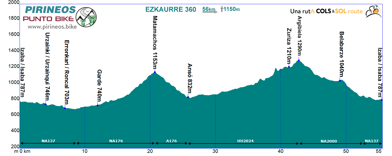
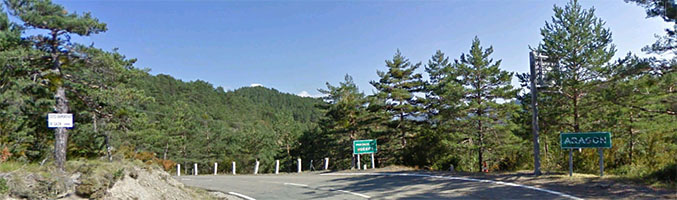
Itinerarie: Isaba NA137 - Roncal - NA176 - Garde - Pto. Matamachos A176 - Ansó HU2024 - Zuriza - Pto. Argibiela NA2000 - NA137 Isaba
If you want to see the route on wikiloc website click on the green icon on the map.
Comenzamos descendiendo hacia el sur hasta un poco después de Roncal donde giramos a la izda, junto a la ermita de San Martín, en busca de Garde.
A los 4 kilómetros de Garde comienza la ascensión, 5 kilómetros escasos a casi un 7% de pendiente media con algunas rampas que superan el 10% en el último kilómetro.
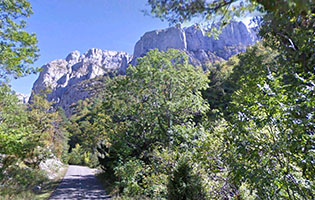
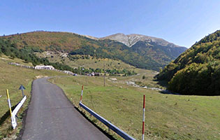
De la cima nos dejamos caer durante 5 kilómetros hasta la localidad oscense de Ansó, donde tomamos rumbo norte. En el transcurso de los próximos 16 kilómetros nos iremos adentrando entre espectaculares paredes. A nuestro lado, constante, el rio Veral y a la izquierda Peña Ezkaurre. A la derecha el macizo de Alanos, al final -donde el paisaje se abre- Zuriza (posibilidad de avituallamiento en el refugio que se encuentra 700 metros más adelante del cruce que tomamos a la izquierda).
En un kilómetro escaso habremos alcanzado el puerto de Navarra que separa la Peña de Ezkaurre del resto de la cordillera. Descendemos y atravesamos llaneando cómodamente los prados de Belabarze hasta entrar en el bosque que nos desciende hasta el fondo del valle de Belagua. 3 kilómetros más en ligero descenso al lado del río nos pondrán de nuevo en Isaba.
We are where we are, in the Atlantic Pyrenees, with a plain to the North with localities at very low altitude and ports that are close to the 2000m range.
The southern slope is more "human", towns are in a higher altitude and the slopes are not so important.
The vast majority of the routes cover the ports of the "greats": Issarbe, La Piedra de St Martin, Laberouat, Bagargi, Artaburu, Arnostegi, Ahuski, Larrau...with slopes ranging between 1000 and 1700 meters. Some routes ascent one of these ports, others 2 or 3 and even more.
We anticipated this so the criteria are clear for each 6 levels that we have chosen for the ranking of the routes.
- Walks or family routes: Routes with light slopes and little travel. Suitable for untrained family groups or for people who usually don't use the bike.
- Easy: Routes with a slope that can reach 1000 meters but facing none of the large ports.
The distance will range between 40 and 60 kilometers. - Moderate: Routes with one of the "great" ports or a combination of similar difficulty. The slopes can be really important and slopes can range between 1000 and 2000 meters.
An example of "moderate" is the Artzaiak S stage through Bagargi. The port is tough, but it is the only major difficulty of the day, i.e. we have the whole day for this task, that’s why we left it in "moderate"..
The distance will vary between 60 and 100 kilometers. - Hard: Routes with a slope ranging around 2500 meters. There may have to ascend 2 ports of the "greats" or one and several of the "minor".
The distance will vary between 90 and 130 kilometers. An example of how difficult it can be, will be the short route of the well-known Larra-Larrau. - Very hard: Routes ranging from the 2500 and 4000 meters of altitude. Sometimes there may have to ascend the 3 ports of the '' greats ''. The distance will exceed the 100 kilometers and may reach the 200.
The long route of Larra-Larrau is one of the exponents of how difficult this route is. - Challenge: In these times there is a public that demands "more" yet. To them arises the concept of "challenge": stages of more than a day in "non-stop" mode, 4500-5000 or even more meters of altitude routes, individual or group time trial with 3000 meters of altitude and over 100 kilometers of route.
Finally, a variety of what riders would usually call "nonsense" which to be more elegant, here we call it, 'Challenges'.
 Return